Manor Lakes is a planned community within the City of Wyndham, located 40 kilometres west of Melbourne and seven km from Werribee – once a major regional town, now drawn into the conurbation of Greater Melbourne. Formerly part of the suburb of Wyndham Vale, in April 2016 Manor Lakes became a suburb in its own right.
Despite its relative newness, the land on which the planned community of Manor Lakes sits and the surrounding regions of the Werribee plains have a long history, stretching far beyond colonial times. Its traditional Indigenous owners, the Wathwaurong people, lived on the land for over 25,000 years before being dispossessed by European squatters in the earliest years of European colonisation. Werribee is named for the Indigenous word for the river that runs through the plains to the sea, while the Werribee Plains, on which it sits, were known to the local people as Iramoo.
The earliest Europeans to visit the area were explorers Hamilton Hume and William Hovell in 1824, although earlier expeditions had made contact with coastal Wathwaurong people in the first years of the nineteenth century. John Helder Wedge surveyed the area for John Batman, and this area was included in the land obtained from ‘native chiefs’ by the latter via the ‘treaty’ of Geelong and Dutigalla on 6 June 1835.
The map showing the land ‘acquired’ in this so-called treaty labels the area to the west of Melbourne around where Manor Lakes is now sited as ‘Fine Open Plains’. These ‘fine plains’, with the abundant water source of the river and nearby creeks, showed great potential for farming, particularly the lucrative grazing of sheep. This was part of a wool boom that would see 4.5 million kg of wool exported to Britain by 1839. Despite Batman’s invalid treaty, the land was claimed by the Crown and soon sold to Europeans, heralding the beginning of the dispossession of the local Indigenous people.
One family of landowners were Scottish immigrants Thomas and Andrew Chirnside, who arrived from New South Wales in 1839 and 1841. They began to buy up farmland throughout Port Phillip; by 1875 this had expanded to 250,000 acres freehold throughout Victoria, including Werribee Park, with its 93,000 acres of sheep and grand mansion. Thomas’s 80,000 acres around Wyndham included the 20,000-acre estate, Lollypop, which he took over on the death of the original owner, James Anderson; Manor Lakes now stands on part of this land.
The village of Wyndham, named after Scottish Soldier Henry Wyndham, developed as a convenient stopping point on the road from Geelong to Melbourne, with a train line and station established in 1857 and a post office in 1858. It developed into a significant node for the Melbourne to Geelong route but also as a centre for the surrounding farmers and landowners. It was not until 1884 that it was renamed Werribee, after the river that ran through it.
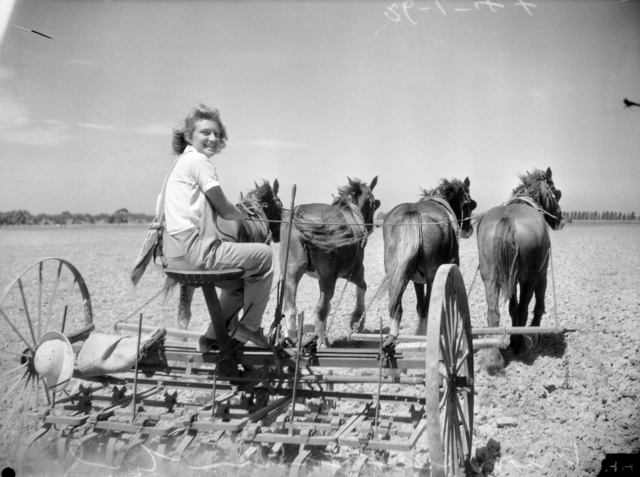
The 1890s and early twentieth century saw diversification of the land in Werribee Shire with a move from pastoralism to farming of crops such as wheat and hay, including the introduction of tenant farmers to the Werribee Park Estate. The Melbourne and Metropolitan Board of Works also purchased almost 9,000 acres from the Chirnsides and established the Metropolitan Farm, ‘a sewerage filtration system on 3,580 ha. of land west of the Werribee River’, (Victorian Places) with a sideline in beef cattle.
Following World War I, returned servicemen took up land in rural Victoria as part of the state’s soldier settlement scheme, including land in Mambourin Parish, near to where Manor Lakes now stands. Many servicemen were unsuited to farm work due to their lack of background in agricultural life, or possibly war injuries, and walked off the land. Immigrants from Italy established extensive market gardens in the 1920s on the former sheep runs surrounding Werribee Park Mansion, having taken up land as the tenants of the Roman Catholic Church, which purchased the property and developed it as a secondary college.
The 1970s saw increased housing development and the region around Werribee became a Metropolitan Growth Area. The City of Wyndham now grows by about 10,000 people per year, with new housing developments pushing out the urban boundary of Greater Melbourne. In the 2011 census, the majority of Wyndham Vale residents were Australian born, having moved from inner Melbourne and other parts of Australia to take advantage of the perceived country lifestyle within a suburban setting. But the area is also home to a small Indigenous population (0.2%), and significant numbers of people born overseas (25%) or from non-English speaking backgrounds (18%). This diverse community includes people from New Zealand, India, China, Italy, the Pacific Islands, Thailand and refugees from countries such as Sudan and Burma.
The small suburb of Manor Lakes has developed from a housing estate that was established in 1994 into a planned community with schools, a shopping centre, library, sporting clubs and facilities, walking and cycling paths and a newly built train station, connecting the suburb to Melbourne. Only about half amount of the land slated for development in the area has yet been built on or released and in the future will stretch further to the east and south of the current suburb.
References & Further Reading
‘Advertising‘, The Argus, 7 February 1850, 4
Australian Associated Press, ‘Melbourne to squeeze in 284,000 homes‘, The Age, 17 June 2009
‘Batmania‘, National Museum Australia of Australia (n.d.)
Public Record Office Victoria, Battle to farm: WWI Soldier Settlement records in Victoria (2016)
‘Cocoroc‘, Victorian Places (2015)
Dennis Family Corporation Pty Ltd, Manor Lakes (2016)
Department of Planning & Development, ‘Registered Aboriginal Parties: Wathwaurung Aboriginal Corporation – Appointed RAP Area‘, Department of Premier & Cabinet (n.d.)
Growth Areas Authority, ‘Amendment C154 to the Wyndham Planning scheme: Manor Lakes – Precinct Structure Plan‘, Victorian Planning Authority (Melbourne: Victorian Government, 2012)
Heritage Council Victoria, ‘Werribee Park‘, Victorian Heritage Database (20 March 2007)
Heritage Council Victoria, ‘Anderson’s Homestead‘, Victorian Heritage Database (20 March 2007)
id. the population experts, ‘City of Wyndham: community profile – Wyndham Vale’, profile.id (n.d.)
Ken James & Lance Pritchard, Werribee: the first one hundred years (Werribee, Vic.: Werribee District Historical Society Inc., 2008)
Maria Mantello, Now and then: the Sicilian farming community at Werribee Park (Carlton: Il Globo, 1986)
Manor Lakes Website
Esther Murray, The plains of Iramoo (Werribee, Vic.: E. Murray, 1974)
Caroline Schelle, ‘Wyndham’s newest suburb officially named Manor Lakes‘, Wyndham Leader, 16 April 2016
Map of part of New Holland shewing the of Territory Geelong and Dutigalla: acquired by Treaty with the Native Chiefs, 6 June 1835, 1835? Attributed to John Helder Wedge (surveyor-draughtsman). State Library New South Wales, Q83/72 [v. 2].
Werribee District Historical Society & Museum Website
Werribee Shire Council, Werribee Shire (Werribee: Werribee Shire Council, 1979)
Wyndham City Council, Wyndham: Our Story (2013)